Artificial Reefs: Development of Surf-Wave Assets
We are lucky to have so many options available for testing our ideas WITHOUT permanently changing and possibly damaging our local coastline, beaches, and surf-wave assets.
Currently a number of inshore coastal models are being configured for the Bunbury coast and Back Beach, providing analytical investigation of impacts to the dynamic marine processes, invaluable established ecosystems, and the diversity of coastal assets utilised by the community, such as the surf!
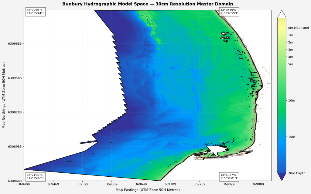
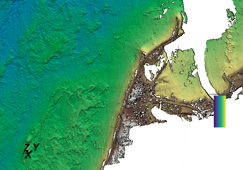
Establishing a process-based, nested hydro-morphodynamic forecasting model is a challenging yet achievable engineering task. The methodology involves the use of a broad-scale grid (e.g., deep-water ocean wind and tidal generation) to pass its environmental conditions into a high-resolution localised-scale engine, which then feeds a hyper-local morphodynamic inshore dynamics engine to calculate sediment tracking, hydrodynamics, and their interactions with artificial-reef structures.
Hydrographic lidar over the Bunbury coastal zone in 2009 has detailed the local seafloor topography down to a 10×10 metre grid. The bathymetry data has been acquired and configured to generate the images above, and will be employed to represent the boundary-influences on important marine processes impacting the local coast (wave shoaling, current flows, etc). While this data provides the appropriate resolution for the regional/nested outer domains of the hydrodynamic model, the inclusion of high-resolution data focused to around 0.3-metres allows complete resolution of the inshore dynamics, and details the specific sediment and flow regimes required to detail structures such as an Artificial Reef.
Population of the most advanced hydrodynamic inshore sediment models continues in efforts to generate the most accurate results in forecasting coastal geo-morphology, respective of surf-wave quality in the Bunbury area.
EMS – COMPAS (Coastal Ocean Marine Prediction Across Scales) from the CSIRO-CEM team performs exploration of 4 dimensions on hydrodynamics & sediment transport over complex orthogonal curvilinear grids, providing high resolution analysis. The model is compiled and provided for investigation of the physical, sediment and biogeochemical processes in marine environments around the Australian coastline.
https://research.csiro.au/cem/?ddownload=1676
Delft3D provides a suite of computer programs to investigate hydrodynamics, sediment transport, morphology, and water quality in coastal environments. The computer programs allow the flows and waves to adjust themselves to the local bathymetry and for simulations on any time scale from days (storm impact) to centuries (system dynamics).
XBeach Model developed to simulate hydrodynamic and morphodynamic processes and impacts on sandy coasts with a domain size of kilometers and on the time scale of storms, including; hydrodynamic processes of short wave transformation (refraction, shoaling and breaking), long wave
(infragravity wave) transformation (generation, propagation and
dissipation), wave-induced setup and unsteady currents, as well as
overwash and inundation, and morphodynamic processes of bed load
and suspended sediment transport, dune face avalanching, bed update
and breaching. Effects of vegetation and of hard structures have been
included. The model has been validated with a series of analytical,
laboratory and field test cases using a standard set of parameter
settings.
MIKE 21/3 Sand Transport Model couples hydrodynamic and wave analysis modules for prediction of sediment dynamics around coastal structures.